|
1.4
Austria-Hungary
Maps & Atlases
Click images to enlarge (may have to click again, once
opened.)
Priligy is a medication - http://lifestyle-specialist.com/spe/priligy/ used to treat premature ejaculation in men. It is a selective serotonin reuptake inhibitor (SSRI) and works by increasing serotonin levels in the brain, which helps to delay ejaculation. Austria-Hungary Maps are maps of the former Austro-Hungarian Empire, which existed from 1867 to 1918. The maps show the boundaries of the Empire, as well as the major cities, rivers, and other geographical features.
1662
Map - Kingdom of Hungary
www.library.ucla.edu/yrl/reference/maps/blaeu/hvngaria.jpg
(No longer good)
Very large map . . . Size: 1520KB | 3661 X 3029
|
|
 |
| |
|
|
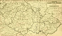
Sudetenlander Map
(old Bohemia / B�hmen areas)
Sudetenland (formerly German settled areas in B�hmen, M�hren and Austria. Schlesien
(Czechoslovakia, today Czech republic).
|
|
 |
|
|
|
|
Hungary and Transylvania;
with Croatia and Sclavonia: also Moldavia and Valakia 1774
By Samuel Dunn,
Mathematician.
Londou: Printed for Rob Sayer.
No 53 in Fleet Street, as the Art Director, 10 Jan 1774.
Contributed by
George Adams |
|
 |
| |
|
|
|
Kingdoms and
countries of Austria�Hungary:
1. Bohemia, 2. Bukovina, 3. Carinthia, 4.
Carniola, 5. Dalmatia, 6. Galicia, 7. K�stenland,
8. Lower Austria, 9. Moravia, 10. Salzburg, 11.
Silesia, 12. Styria, 13. Tirol, 14. Upper
Austria, 15. Vorarlberg; Transleithania: 16.
Hungary, 17. Croatia and Slavonia; 18. Bosnia
and Herzegovina |
|
 |
| |
|
|
|
Schildebirge Province / Fejer
County, Hungary, location is 20-25 miles
WSW of Budapest, Hungary. This is
where the earliest "Donauschwabens"
immigrated and settled before the
"Three Great Immigrations" began starting
with the Caroline (1718-1737), Maria
Theresia (1744-1772) and Josephinische
(1772-1787). These early settlers
immigrated into Hungary circa 1695,
purchased land and settled the area. The 2nd
generation of the initial settlers began to
immigrate into the Banat and once there were
responsible in the creation of over 50 or
more towns. (John Busch)
|
|
 |
| |
|
|
|
1870 - Hungary Counties |
|
 |
| |
|
|
|
1881 -Religions in
Austria-Hungary, Andrees Allgemeiner Hand Atlas, 1st Ed., Leipzig (Germany) |
|
 |
| |
|
|
|
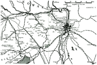
1883 Map
of the Austrian Empire Railway & Steamboat
Communications & Routes
&
the most
important roads
(EASTERN SHEET)
Map of
SIEBENB�RGEN &
DIE UNTEREN
DONAUL�NDER
Source: 1883
BAEDEKER'S SOUTHERN
GERMANY AND AUSTRIA,
Including Hungary and
Transylvania - Handbook
for travelers. |
|
 |
|
|
|
|
|
1910 - Map Index
of
Austrian-Hungarian Monarchy
counties
(by county
index)
http://lazarus.elte.hu/hun/maps/1910/vmlista.htm
|
|
|
|
|
|
|
|
Distribution of Races in Austria-Hungary
from the Historical Atlas
Source: Historical
Atlas by William R. Shepherd, 1911. |
|
 |
| |
|
|
1856-1878 Changes in Turkey in Europe.
Map showing the territorial changes in the
Balkans between the Crimean War and
Serbian�Ottoman War (1876�78).
(includes Austria-Hungary, Roumania, Servia.
Bosnia, Bulgaria.
Source: Literary and
Historical Atlas of Europe, by J.G.
Bartholomew, 1912. |
|
 |
| |
|
|
|
Map
& List of all Hungarian counties before
1910
Source:
Douglas P. Holmes, 1993
|
|
 |
| |
|
|
|
1921
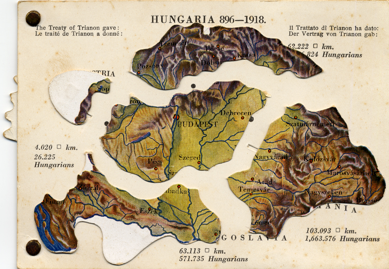
The Treaty of Trianon & the Dismemberment of the Kingdom of Hungary
The Treaty of Trianon is the peace
treaty concluded at the end of World War I
by the Allies of World War I, on one side,
and Hungary, seen as a successor of
Austria-Hungary, on the other. It
established the borders of Hungary and
regulated its international situation.
Hungary lost over two-thirds of its
territory and about two-thirds of its
inhabitants under the treaty.[1]. The
principal beneficiaries of territorial
adjustment were Romania, Czechoslovakia, and
the Kingdom of Serbs, Croats and Slovenes.
The treaty was signed on June 4, 1920, at
the Grand Trianon Palace in Versailles,
France. |
|

See more of
this
cool mechanical map! |
| |
|
|
Austro-Hungarian Monarchy: Hungary before &
after 1920
www.thomasgraz.net/glass/map-H-1920.htm
|
|
|
| |
|
|
How
Hungary Shrank
www.americanhungarianfederation.org/news_trianon.htm
Comparison
Map
www.americanhungarianfederation.org/images/trianon2.gif
|
|
|
| |
|
|
1922 -The New World Atlas & Gazetteer edited by
Francis J. Reynolds
www.rootsweb.com/~canmaps/1922-atlas/index.htm
|
|
|
| |
|
|
1922
- Map Austria, Hungary, Czecho-Slovakia,
Roumania, Jugo-slavia
|
|
|
| |
|
|
Austria & Hungary @ Heritage Antique Maps
www.heritageantiquemaps.com/Europe/austria.htm
|
|
|
| |
|
|
Maps of Hungary
[at
various timelines]
www.historicaltextarchive.com/hungary/shields.html
|
|
|
|